Remote Location Surveys

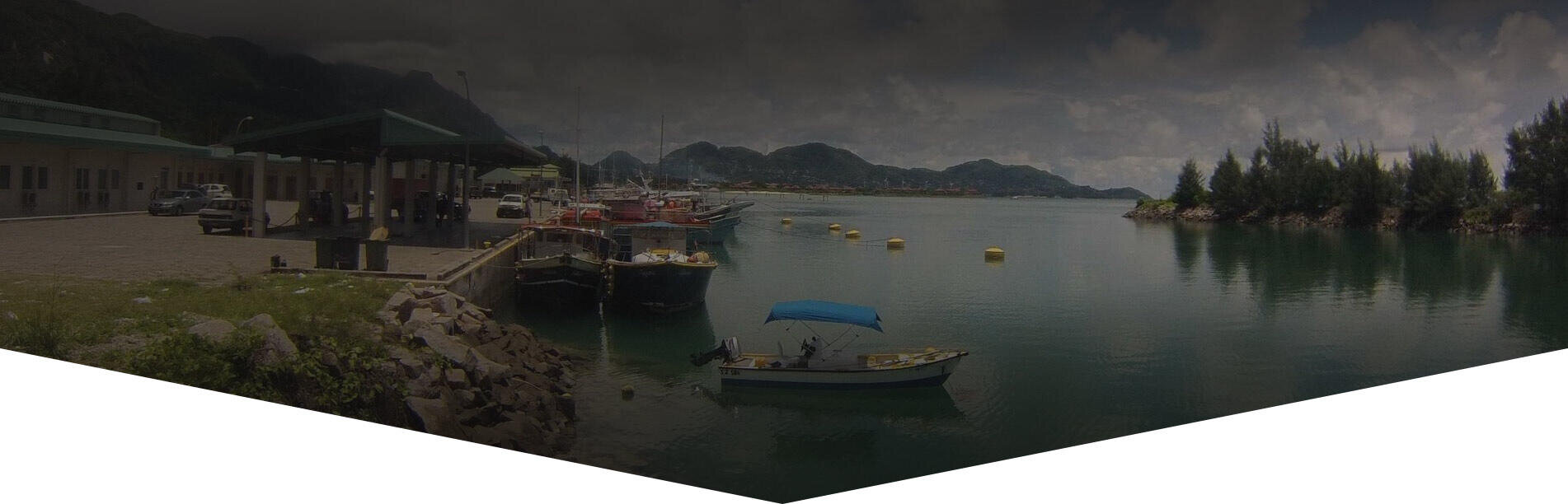
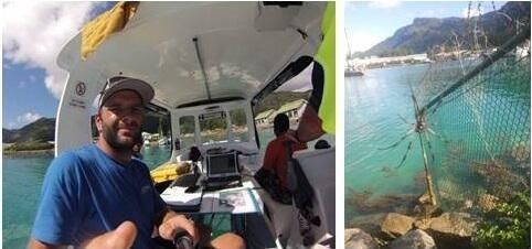
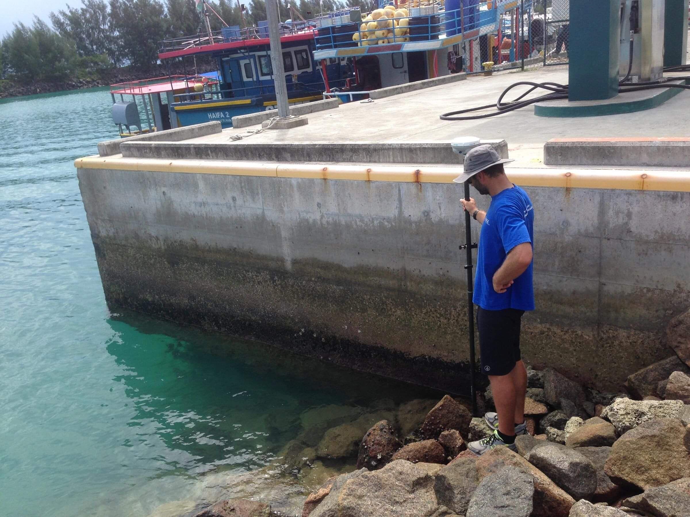
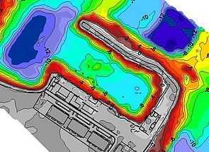
Surveys in remote locations of wharves and ports are an essential tool for inter island transport, trade and fisheries. The surveys are usually undertaken for engineering companies working with international aid agencies and banking institutions supporting the development of island nations or providing support after a weather event. Surveys may consist of Single Beam Echo Sounder (SBES) surveys, Multibeam Echo Sounder Surveys (MBES), cross sections, sediment probing, underwater photography/video, magnetometer surveys and topographic surveys. Local vessels of opportunity are used and range in size from small dinghy's to local charter vessels fitted with Discovery Marine's portable survey sensors and ruggedised computers.

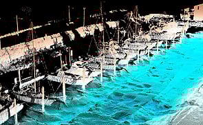
Seychelles - Case Study

Duration: 2 weeks I Date: 2015

Background

Initial studies on the development of the Providence Fishing Port, Mahe Island, began in 2006. Over time the port has been developed using international aid funding to provide a modern port facility to support local fishing activity. Phase 1 was concerned with the initial design and development of the port while Phase 2 is focussing on expansion opportunities and increasing shore based infrastructure such as wharves.

Requirement

The Client required a seamless water/coastal/land solution in order to further design and implement Phase 2 of the Providence fishing harbour. The survey required a hydrographic survey coupled with a topographic survey of the harbour, surrounding approaches, groyne and existing physical structures.

Challenges

Remote locations bring a unique set of challenges including equipment and personel logistics, constantly developing workscopes and unique environments.

Careful planning and years of experience operating throughout the Pacific region have allowed DML to develop rugged compact portable survey systems that will get the job done efficiently, whatever curveball is thrown at the team along the way. DML regularly uses vessels of opportunity ranging from small local fishing and work boats to larger game fishing charter vessels. Each has its own merits, levels of reliability and cost implications depending upon the survey required.

Continually evolving work scope is often the case when you travel to remote locations. Flexibility is key as clients will often adjust the work scope to meet evolving local political and environmental challenges. In the case of the Seychelles the topographic survey suddenly became the priority which relied heavily on DML tying into the local cadastre. Finding out what this meant, the levels of accuracy available and the right people to talk could have been an issue. In the case of the Seychelles they are English speaking and have a well established cadastre loaded into a GIS and available via the web.

Solution

Working closely with the project engineer and the local government survey department, DML linked the bathymetric and topographic survey into the local survey network and provided the design team valuable land parcel, mean sea level and chart datum information prior to departure from the field.

Outcome

Seamless bathymetric and topographic data sets were produced on site with provisional data handed to the Client prior to the DML team departing for New Zealand. This enabled the Client to address any immediate issues which may have impacted the progress of the development.
The Client was happy as the project was completed on time and on budget.

BAY OF PLENTY

Discovery Marine Ltd
42B Tawa Street
Mount Maunganui 3116

Postal Address:
PO Box 4048
Mount Maunganui 
Bay of Plenty 3149
New Zealand

Tel: 0800 365 787 or
0800 DMLSURVEY

AUCKLAND

Discovery Marine Ltd
Unit 1, 15 Ashfield Street
Glenfield
Auckland

Tel: 0800 365 787 or
0800 DMLSURVEY

AUSTRALIA

Discovery Marine Australia Ltd (DMAL)

For all enquiries, please call the freephone number below:

Tel: 1800-625-317