Nautical Charting Surveys
Nautical charting surveys are conducted by hydrographic surveyors working to both national and international standards such as the International Hydrographic Orgainsation (IHO) specifications, S-44. Hydrography is the science of measurement and description of features which affect maritime navigation, marine construction, dredging, oil and gas exploration and related activities. Strong emphasis is placed on soundings, shorelines, tides, currents, seabed and submerged obstructions.
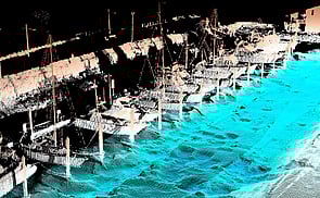
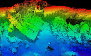
The surveys may use a variety of sensors/techniques including Single Beam Echo Sounders (SBES), Side Scan Sonar, Multibeam Echo Sounders(MBES), Sound Velocity Profilers, temperature & salinity sensors, sediment sampling, ADCP, Mobile Laser Scanning (MLS), underwater photography/video, drone photography, motion senors and RTK/WAGNSS positioning. Discovery Marine undertakes nautical charting surveys using vessels ranging in size from 5m.
Hokianga Harbour - Case Study
Client: Land information New Zealand I Duration: 68 days I Date: 2015
Requirement
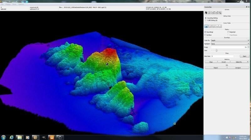
In order to update the chart Land Information New Zealand required a new hydrographic survey of the harbour and approaches. A Multibeam Echo Sounder (MBES), Singlebeam Echo Sounder (SBES) and Side Scan Sonar were used in conjunction with 30+ days of tidal observations, bottom sampling, positioning of navigational aids and low water inspections to deliver an up to date survey.
Background
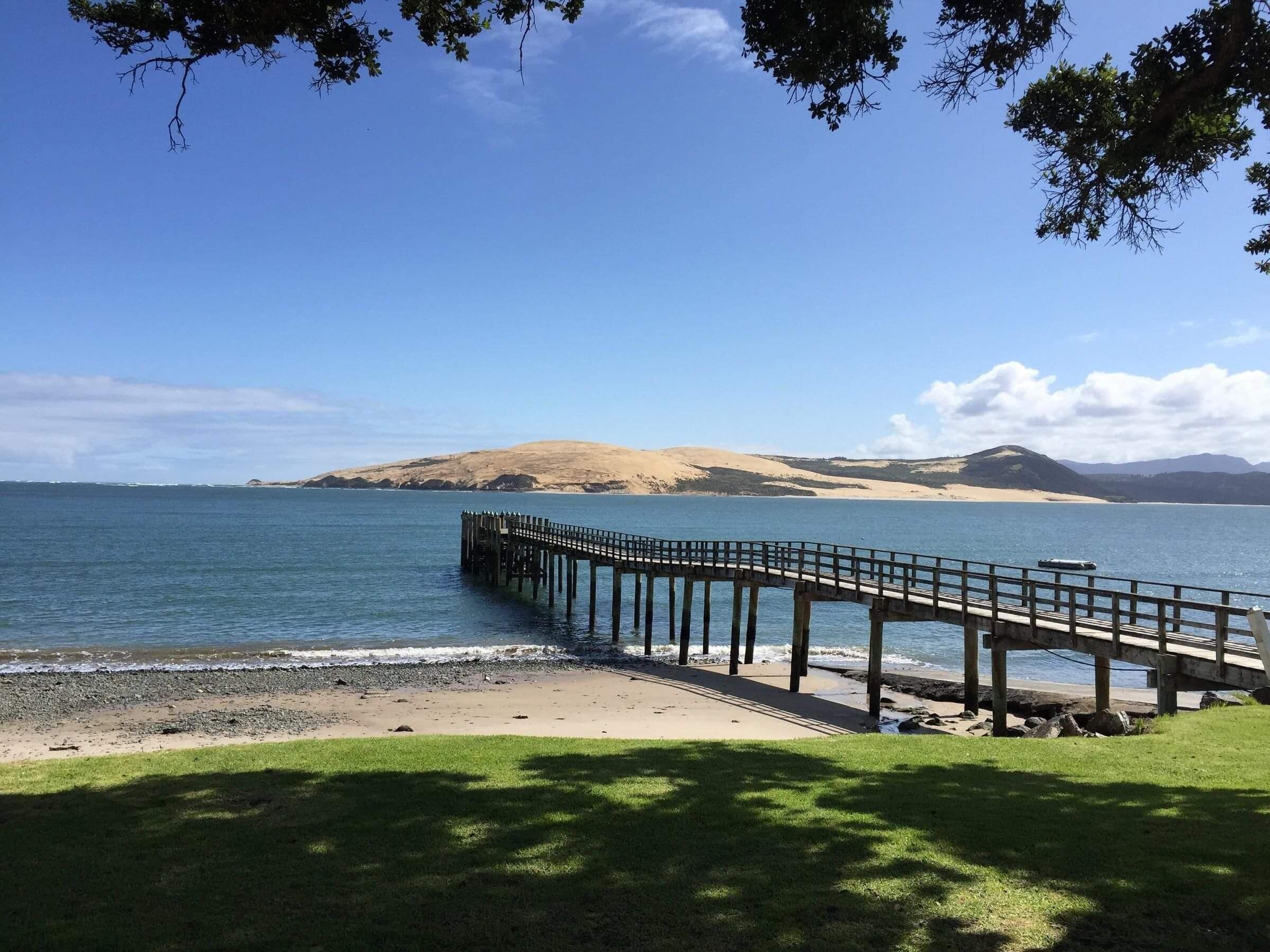
Hokianga Harbour is located on the west coast of the North Island and extends inland for almost 20 nautical miles. The Harbour is of large historical significance with access from seaward either over a treacherous bar or along a narrow channel close under the south headland. This west coast harbour experiences constant swell and rough conditions outside the bar are common place. The seaside town of Omapere is located just inside the entrance while Opononi is located a little further up the Harbour. The largest settlement, Rawene, is located halfway up the Harbour with a car ferry operating throughout the year, which crosses the channel to Kohukohu. North of Kohukohu the Harbour splits into three progressively shallow mangrove lined channels into the interior.
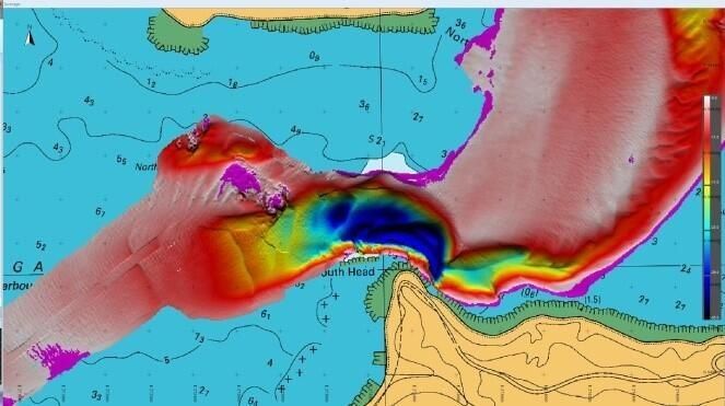
Hokianga Harbour Approaches was depicted on charts NZ 42 (1:200,000) and on chart NZ 4212 (1:40,000) with much of the chart being compiled from the last survey undertaken in 1966. The survey undertaken by DML confirmed that the main channels had altered dramatically since the 1966 survey.
Challenges
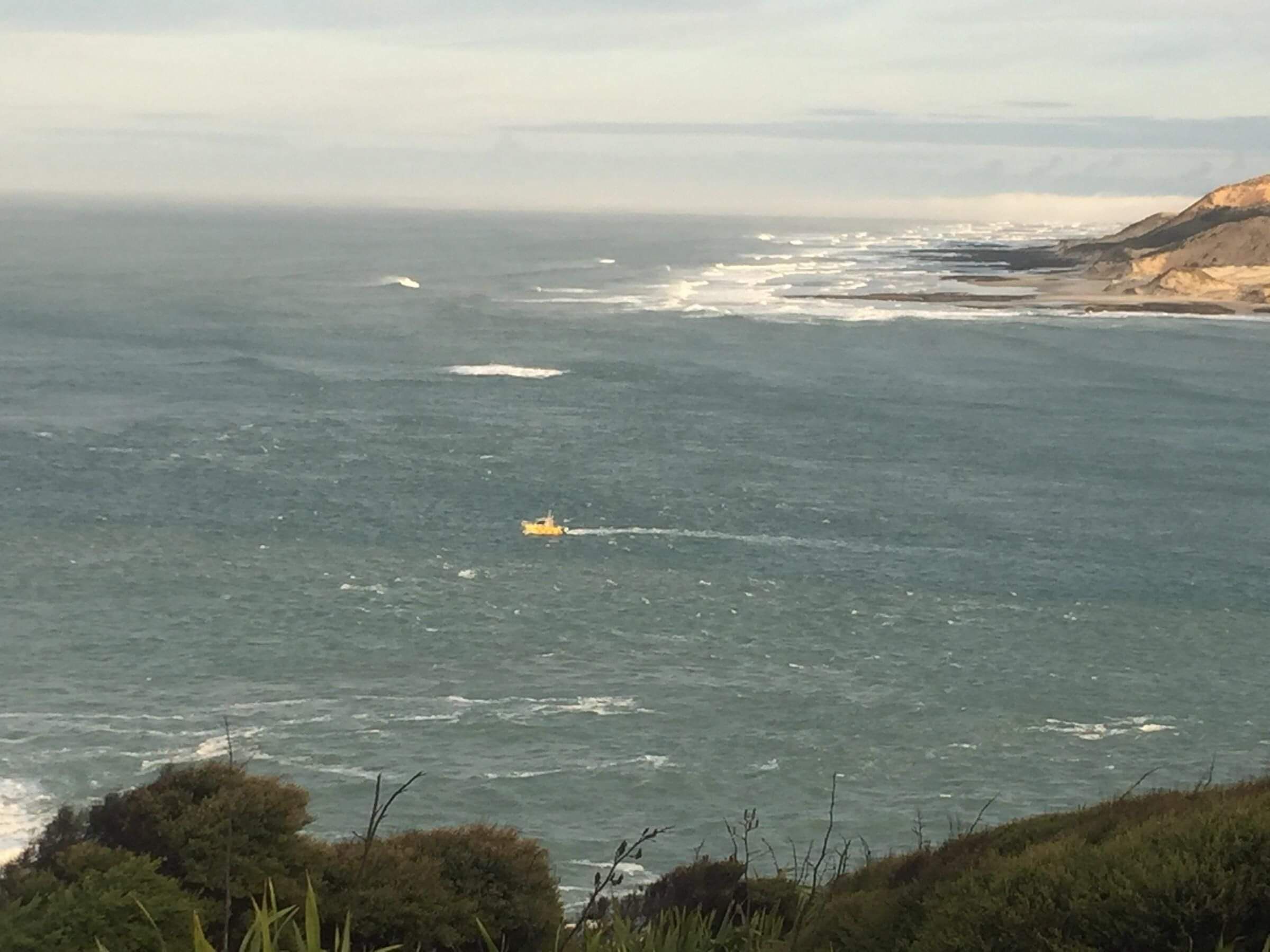
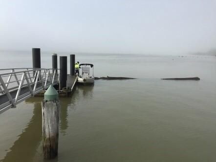
The harbour entrance is exposed to a swell from the South through to the North West. The narrow entrance, shallow bar, North West Reef, South Head cliffs, swift currents, swell reverberation, shallow upper harbour, varying tidal ranges, fog and even floating logs made for a challenging environment to operate vessels and survey equipment.
Solution
DML utilised a three vessel solution to complete the survey of the coastal approaches and inner harbour.
PANDORA II, DML’s 7m alloy catamaran fitted with an MBES and POSMV motion sensor was used to survey depths greater than 5m. PENGUIN, a 5.3m centre console Stabicraft fitted with an SBES and SSS was used to survey all depths inside the harbour from 0-5m. A local, experienced skipper with his commercial 9.5m alloy charter vessel, was engaged to survey the bar using SBES. This vessel was operated with a portable hydrographic survey suite and a survey team of two. The survey team's accommodation was located on the beach front at Omapere with excellent views of the harbour entrance. This enabled the team to view the survey area and to plan the daily survey activities taking into account actual swell, weather and tidal constraints
Outcome
The survey objectives were safely achieved and results were delivered on time and to budget.
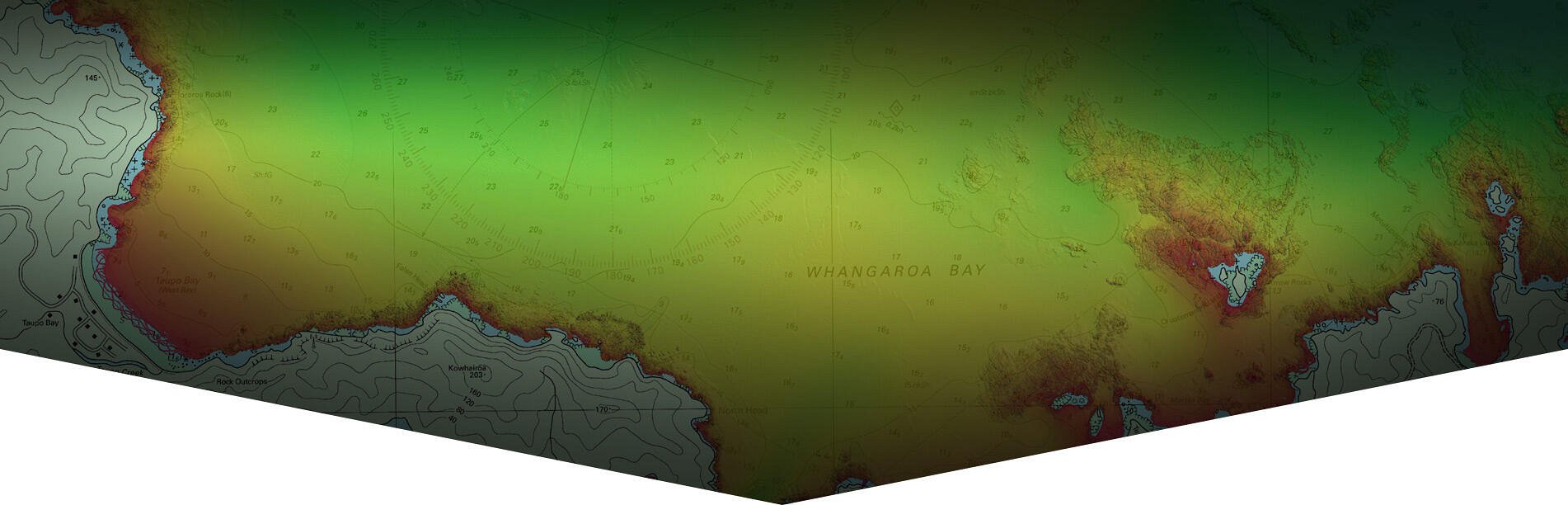
DML has conducted other nautical charting surveys for LINZ including; Approaches to Auckland (2017), Kawau Island (2017), Parengarenga Harbour (2016), Houhora and Mangonui Harbours (2015), Whangaroa Harbour(2014), Bay of Islands (2013), Poor Knights Islands (2011), Hen and Chicken Islands (2010), Patterson Inlet, Stewart Island (2009), Akaroa Harbour (2008), Milford Sound entrance (2008) and Abel Tasman National Park (2008).

BAY OF PLENTY
Discovery Marine Ltd
42B Tawa Street
Mount Maunganui 3116
Postal Address:
PO Box 4048
Mount Maunganui
Bay of Plenty 3149
New Zealand
Tel: 0800 365 787 or
0800 DMLSURVEY
AUCKLAND
Discovery Marine Ltd
Unit 1, 15 Ashfield Street
Glenfield
Auckland
Tel: 0800 365 787 or
0800 DMLSURVEY
AUSTRALIA
Discovery Marine Australia Ltd (DMAL)
For all enquiries, please call the freephone number below:
Tel: 1800-625-317