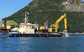
Underwater Asset Imaging
The surveying and imaging of underwater assets is an essential tool for asset management, asset monitoring/repair and the resource consenting process. The surveys typically consist of Multibeam Echo Sounder Surveys (MBES), Side Scan Sonar Surveys below the water combined with Mobile Laser Scanning (MLS) of structures above the water to create 3D point clouds. The vessels used are purposes built survey vessels ranging in size from 5-7m in length fitted with state of the art positioning, motion sensors and portable survey computers.
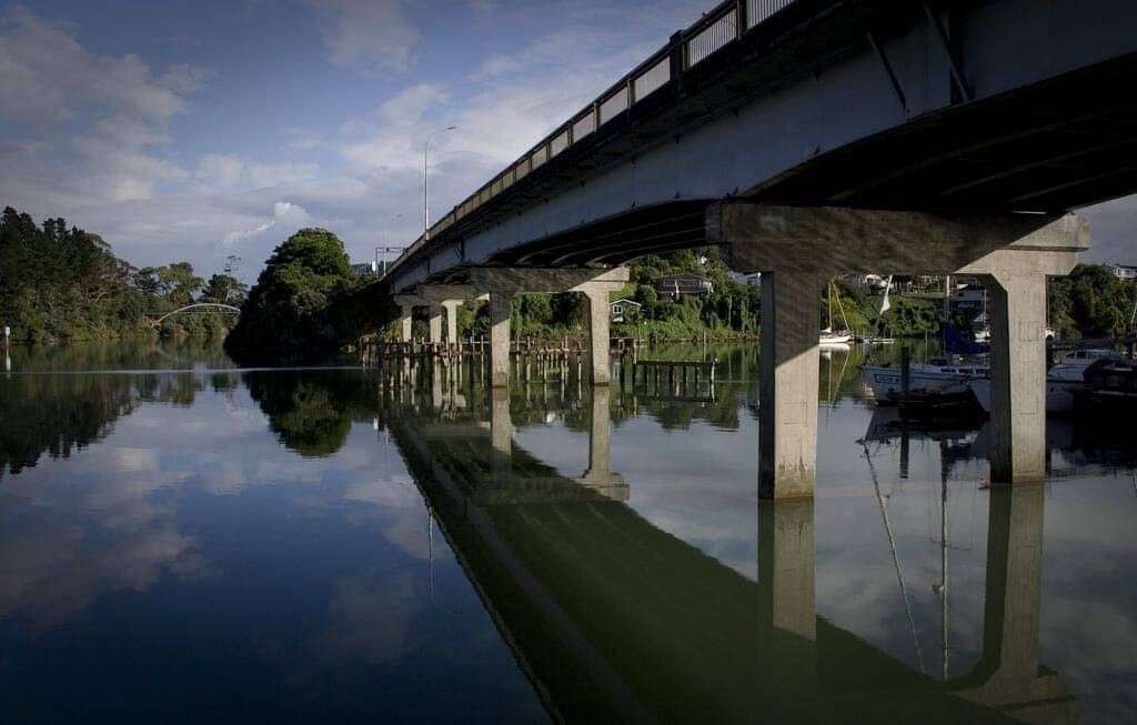
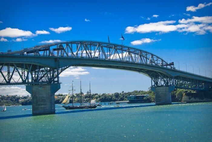
Panmure & Auckland Harbour Bridges - Case Study
Date: 2014-15
Background
Requirements
Challenges
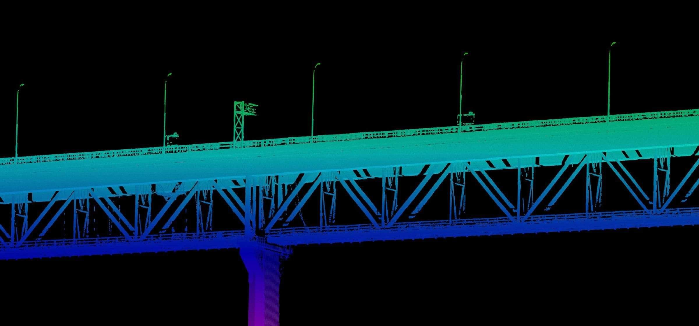
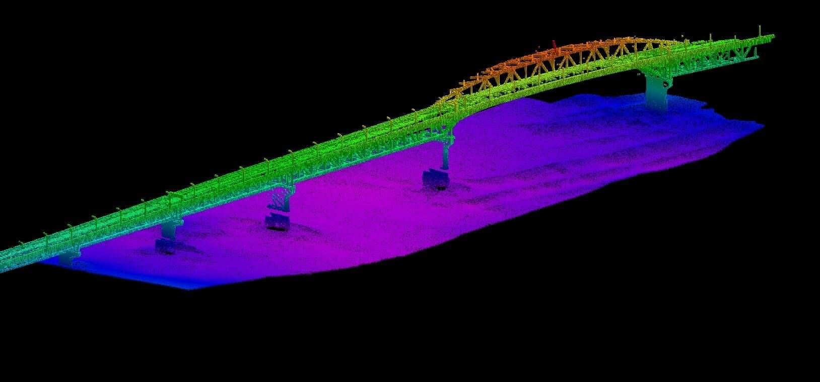
Challenge 1: Managing and understanding the six degrees of vessel motion using a survey quality Inertial Navigation System (INS) to correct TLS and MBES data increases the quality and accuracy of your final data sets.
Challenge 2: The careful online acquisition, management and processing of large volumes of point cloud data in real time is key to reducing post processing effort and deriving accurate results. Daily data volumes range from the hundreds of Gigabytes to Terabytes of data.
Solution
Outcome
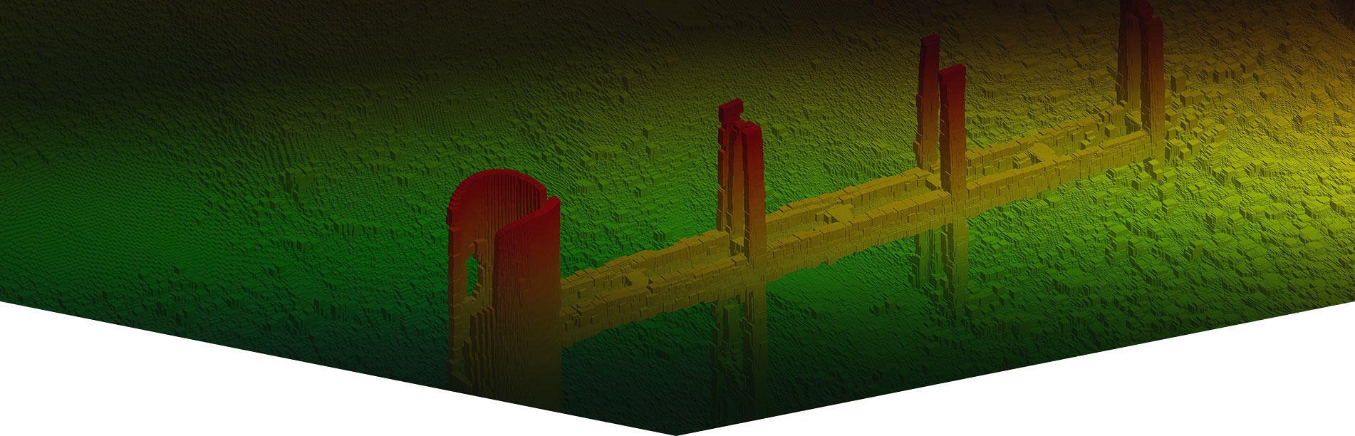
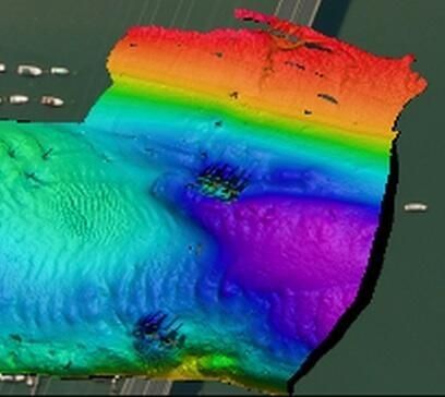
In the case of the TLS and MBES trial, DML showed that a TLS can be successfully integrated to an MBES acquisition system in order to simultaneously survey structures above and below the water line from a vessel.
DML will continue to expand its multi platform survey capability using TLS, MBES, SBES and digital aerial cameras on vessels, vehicles, remotely operated vehicles and drones for all modes of transport including water, road and rail.

BAY OF PLENTY
Discovery Marine Ltd
42B Tawa Street
Mount Maunganui 3116
Postal Address:
PO Box 4048
Mount Maunganui
Bay of Plenty 3149
New Zealand
Tel: 0800 365 787 or
0800 DMLSURVEY
AUCKLAND
Discovery Marine Ltd
Unit 1, 15 Ashfield Street
Glenfield
Auckland
Tel: 0800 365 787 or
0800 DMLSURVEY
AUSTRALIA
Discovery Marine Australia Ltd (DMAL)
For all enquiries, please call the freephone number below:
Tel: 1800-625-317