Erosion Monitoring

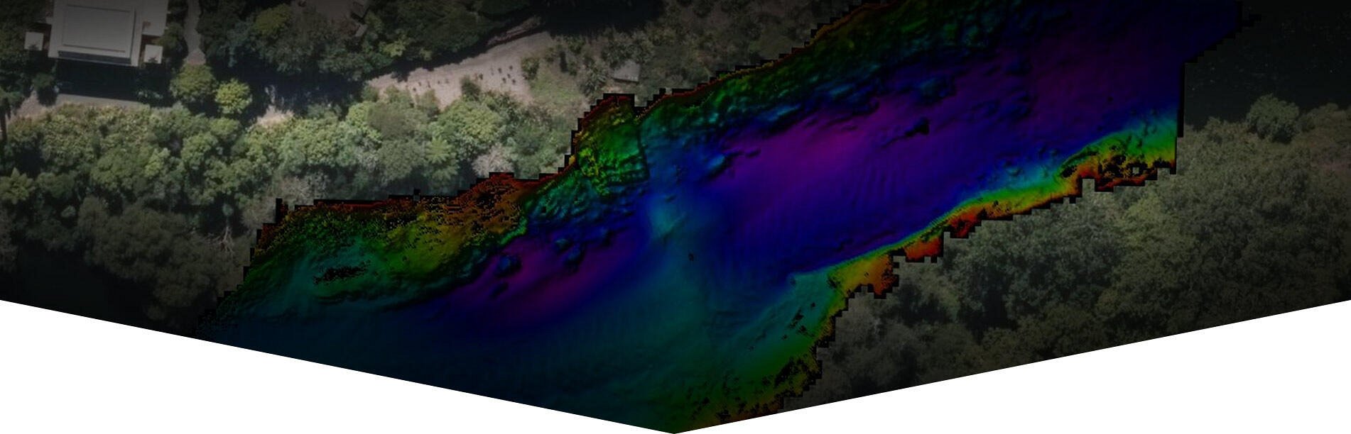
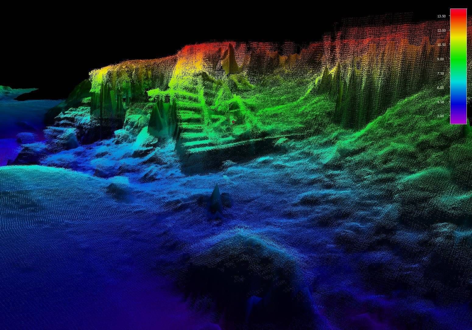
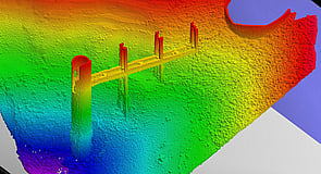
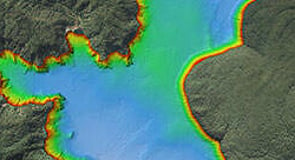
Erosion monitoring of coastlines, river riverbanks and lake shorelines is an essential tool for asset protection, flood management and resource consents. The surveys may consist of cross sections, Single Beam Echo Sounder (SBES) surveys, Multibeam Echo Sounder Surveys (MBES), sediment probing, ADCP surveys and Mobile Laser Scanning (MLS) of the adjacent topography. The surveys can be conducted on foot using RTK positioning & photography, aerial photography using a drone, vehicles fitted with MLS and vessels fitted with SBES/MBES/MLS ranging in size from jetski's to purpose built survey vessels 5-7m in length. All vessels and vehicles can be fitted with state of the art positioning, motion sensors and portable survey computers. 

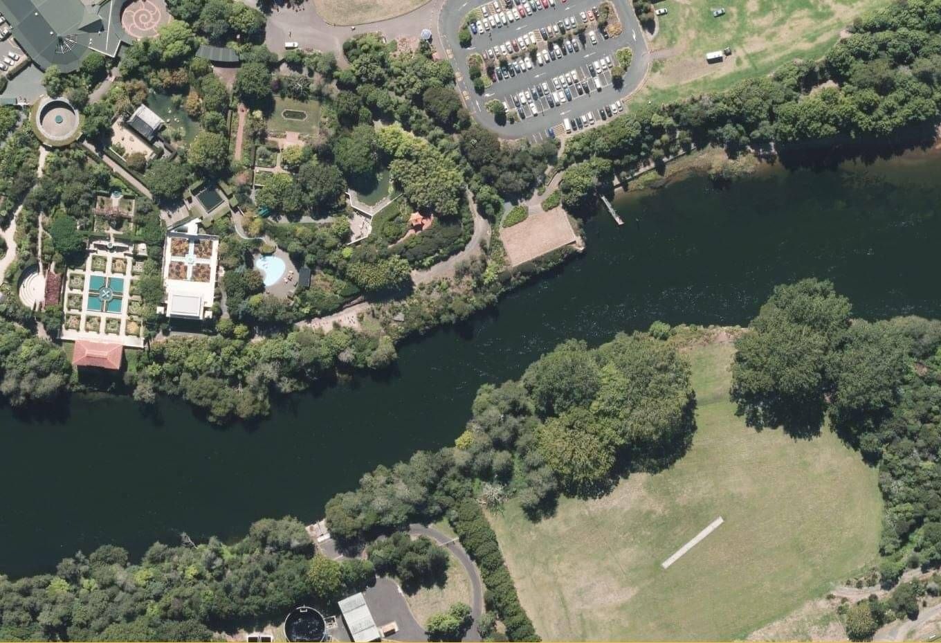
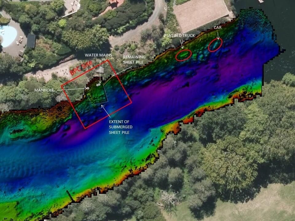
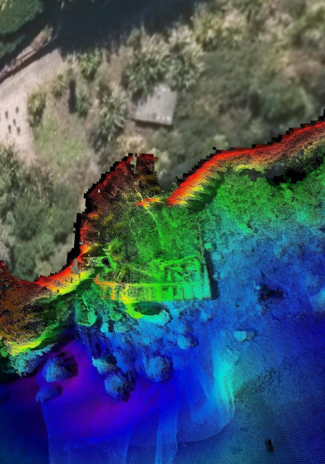
Waikato River - Case Study

Duration: 1 day I Date: 2017

Background

The Waikato River is the longest river in New Zealand, running for 425 kilometres through the North Island of New Zealand. As well as being a water and recreation resource, the river was historically a critical communications and transport link for the communities along it. The river flows through the centre of Hamilton where it is frequently used by rowers, kayakers and powered pleasure craft. Due to its size and large catchment area originating at Lake Taupo, the river also has a series of eight dams and nine hydro-electric power stations that generate electricity for the national grid. Management of the river and its assets are the responsibility of numerous key stakeholders including local councils, regional councils, power generators, the Department of Conservation and other special interest groups such as Fish and Game.

Requirement

Due to the large catchment area and at times, high river volumes, the river banks and bed are subject to erosion. Associated infrastructure such as river paths, dams, storm water culverts/drains, pipelines, power cables and bridges require constant monitoring for erosion.  In this case sheet piling around a storm water outlet was investigated to ascertain possible damage post a flood event, to assist with the planning of any repair work that may have been required.

Challenges

Sheet piling from the collapsed wall required care when operating the multibeam echosounder within  close proximity of the debris field. River flows and currents were monitored in order to avoid the vessel being pushed into the collapsed structure.

Solution

DML undertook a high resolution MBES survey of the the river bank using the MBES mounted at a 30 degree angle in order to project the sonar beams sideways. This enabled as much of the river bank to be surveyed as possible without getting too close. Gridded data sets were derived and provided to the Client along with 3D fly throughs, enabling the Client to investigate the area from all aspects to a very high level of detail.

BAY OF PLENTY

Discovery Marine Ltd
42B Tawa Street
Mount Maunganui 3116

Postal Address:
PO Box 4048
Mount Maunganui 
Bay of Plenty 3149
New Zealand

Tel: 0800 365 787 or
0800 DMLSURVEY

AUCKLAND

Discovery Marine Ltd
Unit 1, 15 Ashfield Street
Glenfield
Auckland

Tel: 0800 365 787 or
0800 DMLSURVEY

AUSTRALIA

Discovery Marine Australia Ltd (DMAL)

For all enquiries, please call the freephone number below:

Tel: 1800-625-317