Habitat Mapping
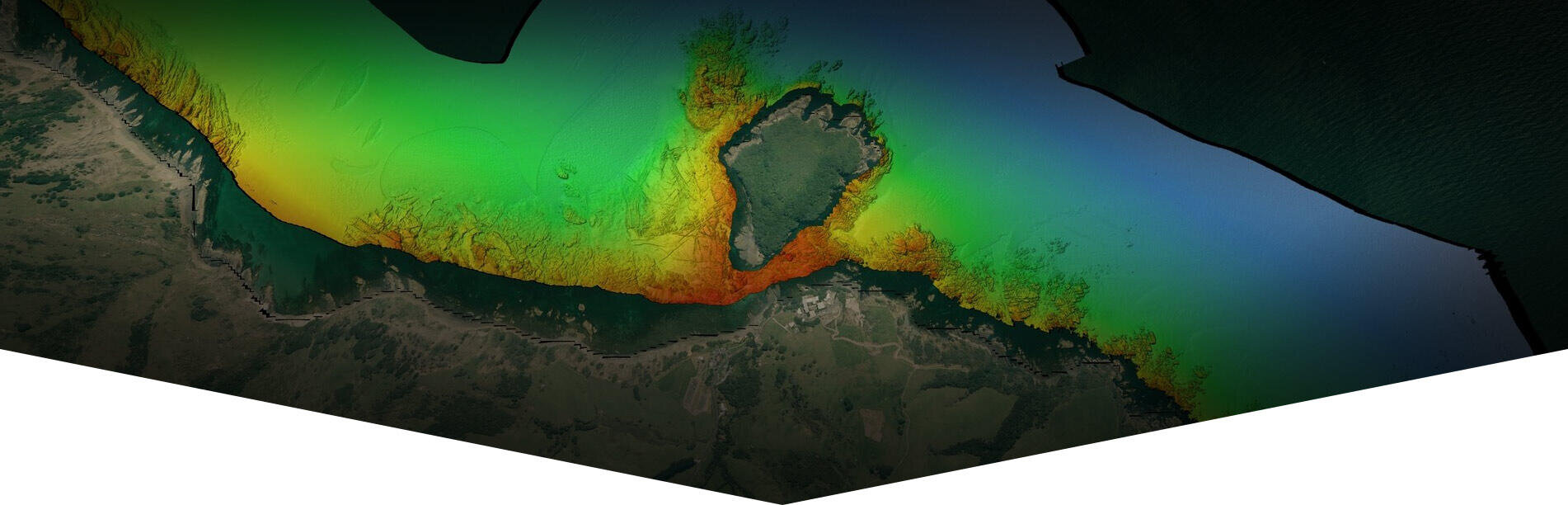
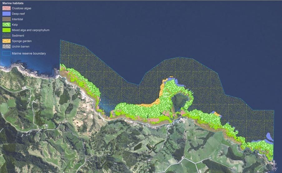
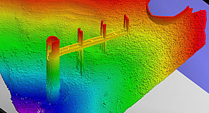
Habitat mapping aims to accurately identify and describe the characteristics of different benthic habitats on the seabed, lakes and rivers. In order to achieve this, multidisciplinary data sets based on geological, biological, chemical and oceanographic observations must be gathered together and analyzed. With varied and integrated data sets a comprehensive picture of the underwater habitat can be created. Multibeam Echo Sounder Surveys (MBES) combined with sediment sampling, SVP/Temperature/Salinity observations and underwater photography/video are captured for further processing, analysis and reporting using Geographic Information Systems (GIS). Discovery Marine uses purpose built survey vessels and vessels of opportunity, fitted with MBES, grab/dredge samplers and underwater cameras to gather the data. The final products reveal the diversity and distribution of marine habitats and serve as a useful tool in marine management.
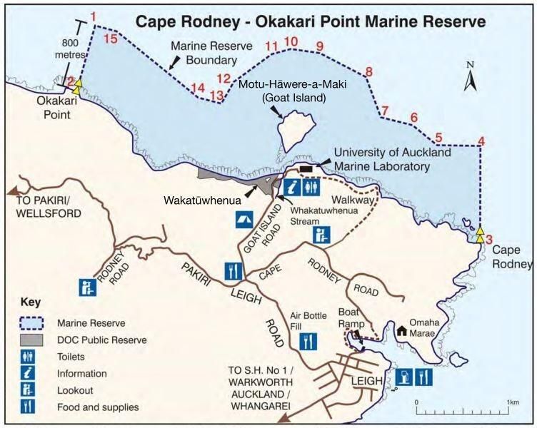
Cape Rodney-Okakari Point Marine Reserve (Goat Island) - Case Study
Client: The University of Auckland, Waikato University, Dep of Conservation I Duration: 5 days I Date: 2014
Requirement
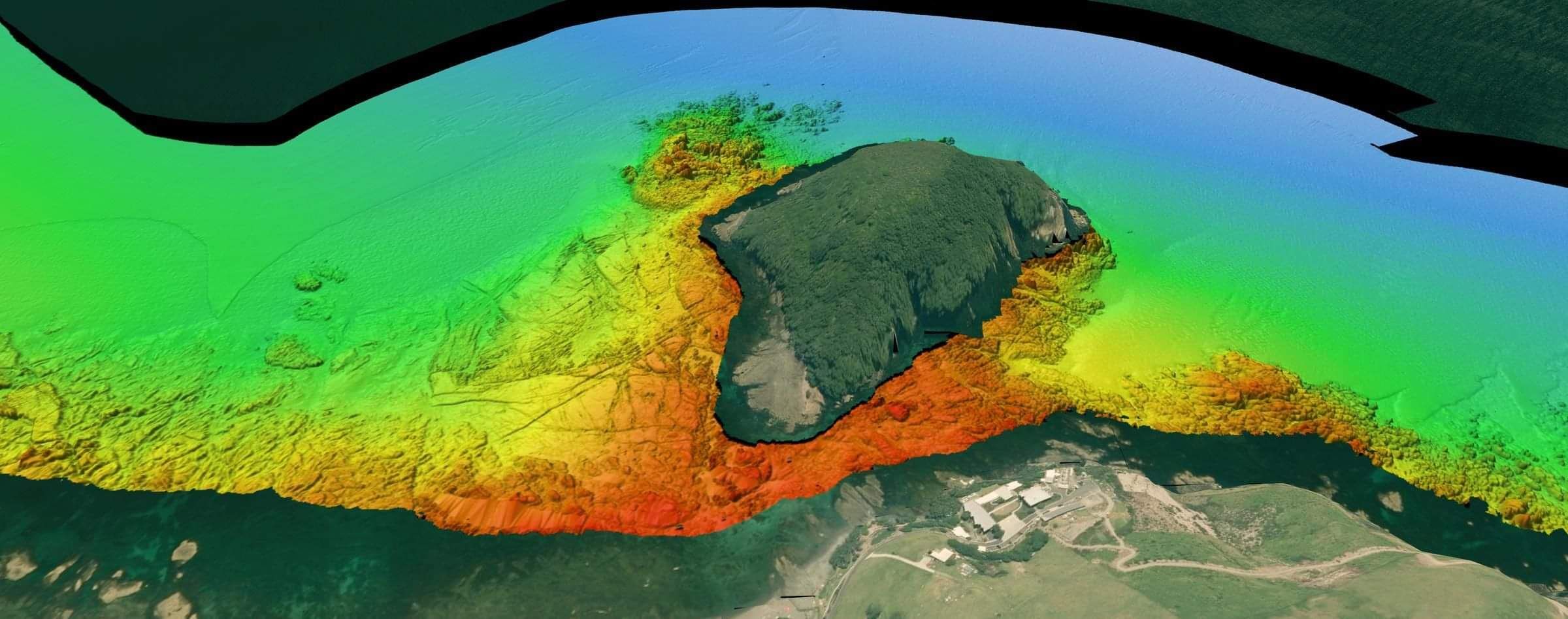
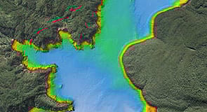
Over the year regular surveys of the marine reserve enable habitat monitoring to take place. A collaborative multibeam survey undertaken by the University of Auckland, Waikato University and the Department of Conservation provided a detailed data set from which to update the habitat maps and to conduct further research by MSc and PHd students alike. The objective of this project was to survey the entire reserve from the deep water boundary to the drying line with the University of Waikato's Reson 7125 MBES.
Background
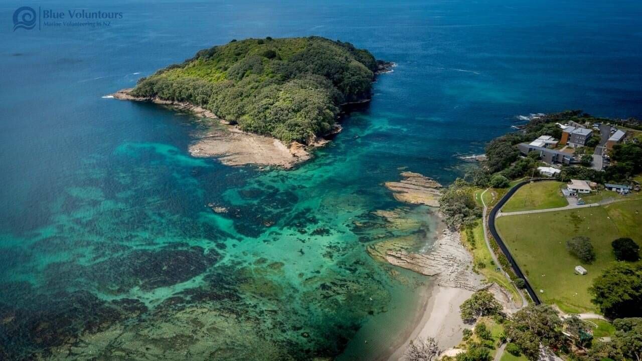
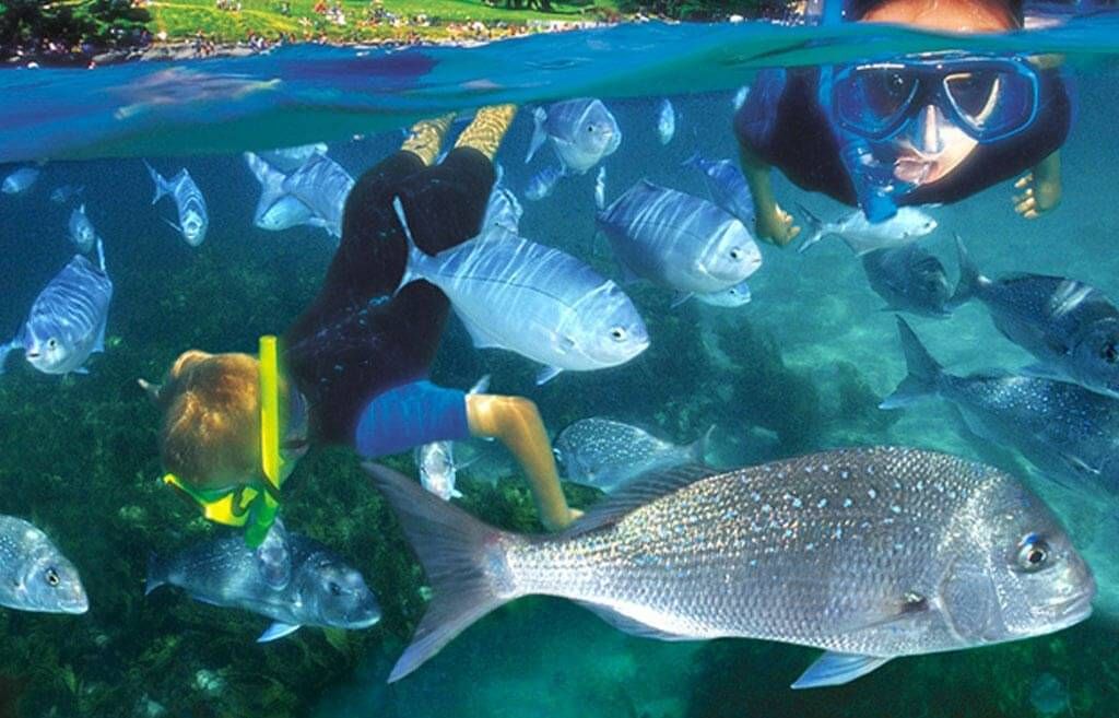
The Cape Rodney-Okakari Marine Reserve is New Zealand’s first marine reserve. Established in 1975, the reserve protects 547 hectares of shore and sea on the north-eastern coast around Cape Rodney, Okakari Point and Te Hāwere-a-Maki/ Goat Island. The marine reserve is about one and a half hours’ drive north of Auckland, near Leigh. Five kilometres of coastline and an area extending 800 m offshore are included in the reserve. Marine life now flourishes in an area where fish populations were once greatly reduced. Crayfish and snapper are now abundant and the reserve has become an important breeding and nursery area for many species.
The University of Auckland’s marine laboratory was established in 1964, before the marine reserve. However staff and students soon discovered that people were eating the experiments, affecting research. It took a further 11 years for the marine reserve to be established and is now one of more than 40 marine reserves around New Zealand.
Challenges
The marine reserve is very shallow and exposed to wind and a swells from the east. The large degree of marine wildlife, complex reef structures and weed provided challenges for vessel operations. Care had to be taken so as not to damage the MBES and still gather as much data as possible.
With the large volume of biomass, including weed, the resulting data took some time to clean and process.
Outcome
The survey of the of the Cape Rodney-Okakari Point Marine Reserve was designed to provide a valuable science data set for future research and to educate the public on the valuable nature of this easily accessible reserve on Auckland's back door step.
For more information on the reserve and how you can enjoy it see https://www.doc.govt.nz/parks-...

BAY OF PLENTY
Discovery Marine Ltd
42B Tawa Street
Mount Maunganui 3116
Postal Address:
PO Box 4048
Mount Maunganui
Bay of Plenty 3149
New Zealand
Tel: 0800 365 787 or
0800 DMLSURVEY
AUCKLAND
Discovery Marine Ltd
Unit 1, 15 Ashfield Street
Glenfield
Auckland
Tel: 0800 365 787 or
0800 DMLSURVEY
AUSTRALIA
Discovery Marine Australia Ltd (DMAL)
For all enquiries, please call the freephone number below:
Tel: 1800-625-317