NAUTICAL CHARTING
Nautical charting surveys are undertaken to ensure safe ship navigation by knowing the precise depths and therefore the under-keel clearance for transiting vessels around New Zealand’s busy coastline and shipping lanes. Land Information New Zealand is tasked with keeping New Zealand’s charts up to date. We are one of two panel providers who undertake regular surveys to achieve this.
We are also the only New Zealand company to provide these services to the Royal Australian Navy.
Nautical charting surveys are some of the most complex and comprehensive surveys we undertake due to their precise and exacting standards.
DML personnel hold IHO Cat A and CPHS Level 1 Certifications; mandatory for meeting Land Information New Zealand requirements.
PORT AND DREDGING SUPPORT
Port and dredging surveys are necessary to ensure the safe vessel operations within ports and harbours. Given the high-stakes environment, appropriately certified hydrographic surveyors should undertake this work. DML’s senior team hold IHO Cat A and/or CPHS Level 1 Certification and have proven knowledge of the sciences involved with hydrographic surveying.
DML is a trusted provider to New Zealand’s largest commercial Ports.
RIVER SURVEYS
River surveys are requested to assist with modelling for flood management, assessing water quality, river-bank management and resource consents. Using vessel mounted echo sounders and mobile laser scanning technology, it’s possible to collect and combine data from below the waterline as well as along river- banks for river management and monitoring.
RESERVOIR & FRESHWATER DAM SURVEYS
Reservoir and dam surveys are requested to assist with submerged asset management, provide dam volume calculations, water quality assessments, lake and river-bank management and resource consents. Using a combination of Multibeam Echo sounders and mobile laser scanning, it’s possible to collect seamless data from below and above the water line to enable 3D visualisation.
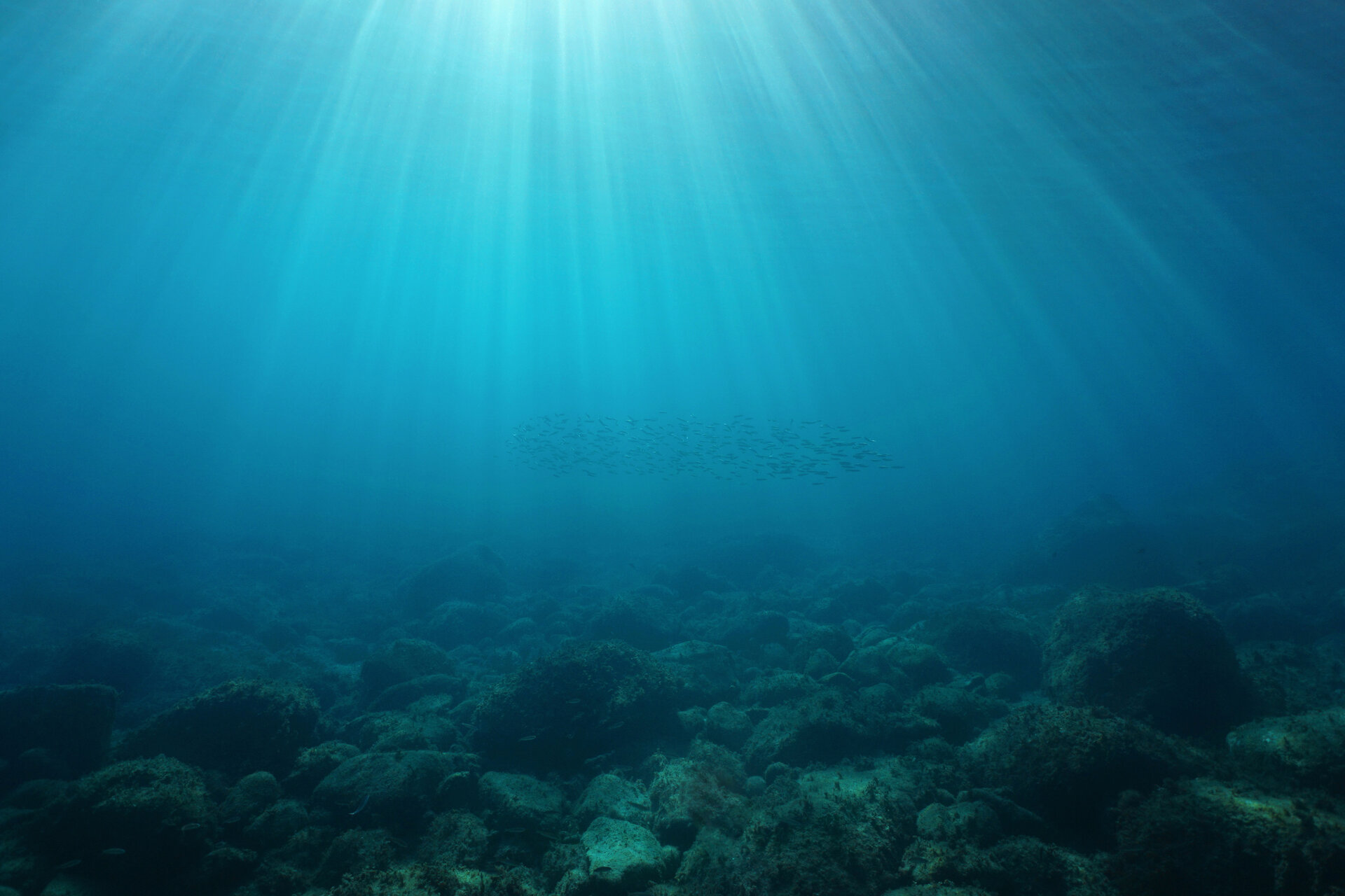
BACKSCATTER & WATER COLUMN DATA
Backscatter and water column data can be collected when undertaking bathymetric surveys and can be used to help answer science questions. Backscatter data can be used to characterise the environment (or habitat) where marine fauna live, and as such can be used to explain spatial patterns of sea floor biology and biodiversity at continuous scales.
Water column data enables 3-D mapping of fish schools and other mid-water marine organisms, assessing biological abundance, species identification, and habitat characterization. The data is also useful for mapping the heights of wrecks, underwater freshwater seeps, gas and oil seeps.
HABITAT MAPPING
Bathymetric data can be used to help define the characteristics of benthic habitats on the seabed, lakes and rivers. With varied and integrated data sets a comprehensive picture of the underwater habitat can be created. Multibeam Echo Sounder Surveys (MBES) combined with sediment sampling, SVP/Temperature/Salinity observations and underwater photography/video are captured for further processing, analysis and reporting using Geographic Information Systems (GIS).
Discovery Marine has provided high-quality survey data to the science community to assist with answering science related questions.
SURVEYS IN REMOTE LOCATIONS
DML provides engineers with survey services in remote locations often in support of International Development and Aid Projects for inter-island transport, trade and fisheries or in response to an environmental event. DML has portable equipment enabling it to be deployed on vessels of opportunity.
CHOICES BECOME CLEARER, AND DECISIONS ARE EASIER TO REACH
WHO USES OUR DATA?
- a pilot guiding a large vessel through a constrained harbour entry
- a coastal scientist predicting impacts of a significant weather event or tsunami
- an engineer planning a coastal sub-division, coastal road or bridge
- a planner managing the volume contained in a city’s water catchment reservoirs
- or, a council assessing the licensing of a fish farm
- a scientist determining marine health, vitality and development prospects
- an engineer establishing wharves or coastal infrastructure in remote locations