
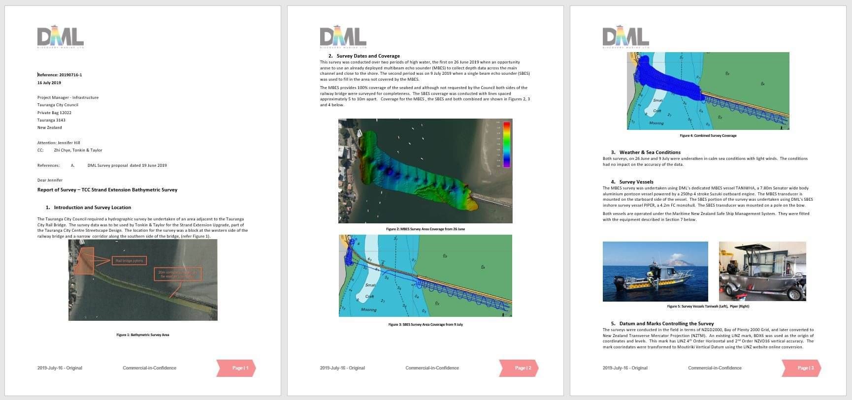
REPORT OF SURVEY
A report of survey is normally requested by all clients as a record of the date, requirement and methodology of the survey. The length and detail of the Report of Survey will vary depending on the complexity and nature of the survey. It's a valuable record should the survey need to be repeated at a future date or where it may be relied on as an evidential record. Our surveyors will ensure that key observations they have uncovered are detailed within the report.
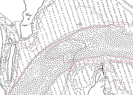
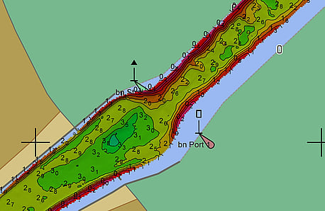
SURVEY PLANS, SOUNDINGS & CONTOURS
Hard copy
174.75769400,-36.73525800,2.7,15/02/17 23:12:58.00
POSITION, DEPTHS, HEIGHTS - ASCII X,Y,Z File
*.txt
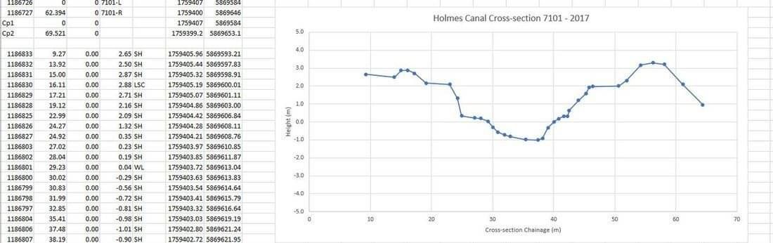
CROSS SECTIONS
*.xlsx
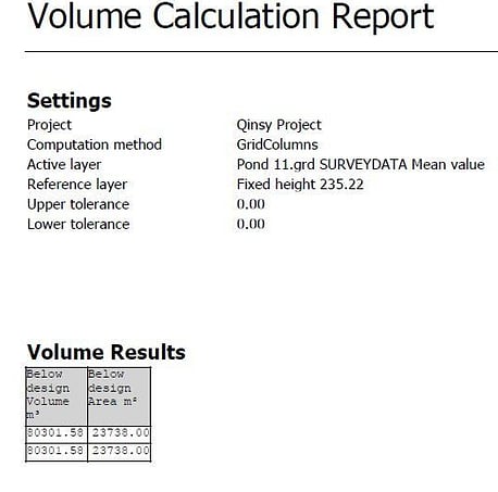
VOLUME CALCULATIONS
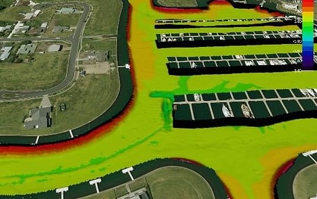
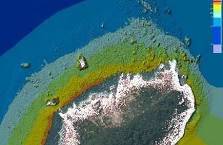
2d/3d Image of survey data. Surface to Surface or Surface to Design Difference Plots
GeoTIFF Images of survey data
*.tif and *.tfw, Geo-referenced raster file in two parts
Gridded bathymetry surface (at fixed cell size e.g. 0.25m, 0.5m, 1.0m
*.grd, *.xyz, *.sd
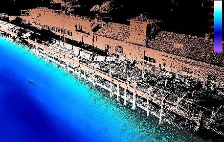
Mobile laser scanner point cloud
*.las, *.xyz, *.laz, *.pts
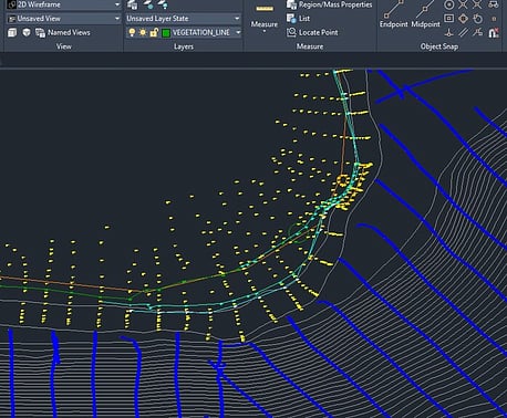
Survey data (sounding points, contours, coastline, topo) in ESRI Shape or Autocad DXF or DWG file format
*.shp, *.dxf, *.dwg
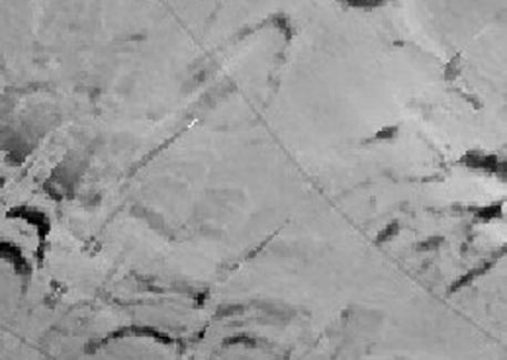
Raw side scan of Multibeam Backscatter XTF Files
*.xtf, eXtended Triton Format
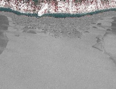
Processed Side scan or MBES Backscatter Mosaic (at best possible resolution e.g. 0.1m, 0.25m, 0.5m)
*.pdf, A4 to A0
*.tif, Image File
*.tif and *.tfw, Geo-referenced raster file in two parts
Image compiled from lines of XTF data.
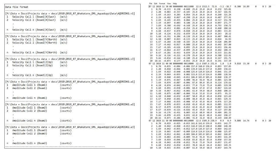
ADCP vector data
*.vel