DAMS & RESERVOIRS
> DAMS & INFRASTRUCTURE SURVEYS
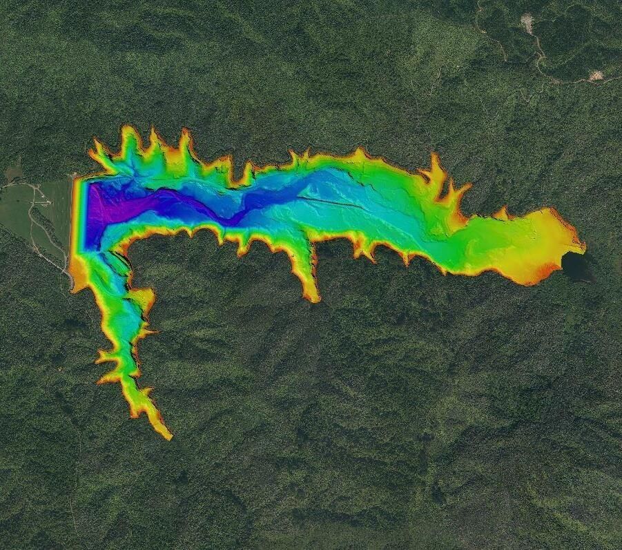
HUNUA WATER SUPPLY RESERVOIRS | CASE STUDY
F I E L D W O R K D U R A T I O N : 9 DAYS
D A T E : 2019
BACKGROUND
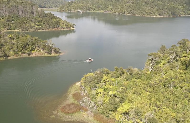
Watercare manages Auckland's freshwater water reservoirs in the Hunua Ranges, South-East of Auckland. The dams undergo regular monitoring for maintenance and are regularly surveyed to enable accurate volume calculations for Auckland's water supply needs.
REQUIREMENT
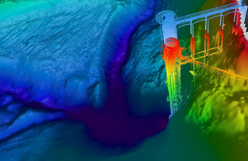
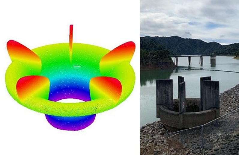
The main objective of the project was to complete a combined hydrographic and topographic survey of each dam and their surrounds, to determine the volume of the reservoirs. In addition, the bell mouth or spill way and dam face were mapped using a combination of Structure from Motion (SfM) via Unmanned aerial Vehicle (UAV) and Total Station (TS) observations.
CHALLENGES
While the dams deep sections were surveyed with out issue the arms provided added difficulty due to:
- partially submerged and fully submerged debris from the surrounding bush;
- the shallow nature and on occasion significant weed growth that hindered progression up the valleys.
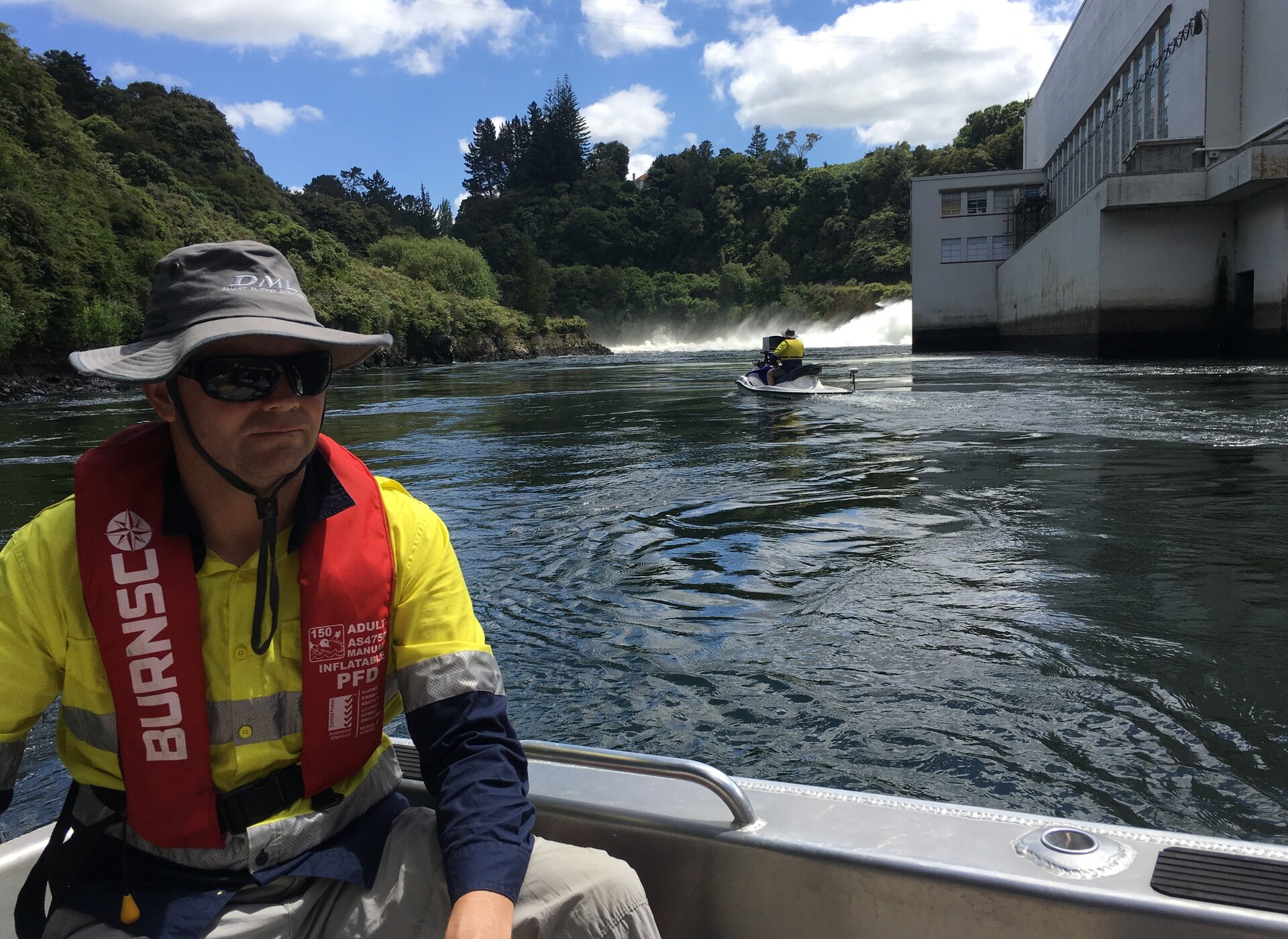
, All of which required caution while navigating the vessel and operating the equipment.
SOLUTION
The approach with each reservoir was to scan the arm edges of the reservoir first with the MBES tilted to 30 degrees to capture the shallowest extents of the bathymetry. As each arm edging was completed the remaining area of the bathymetry was filled in before moving to the next arm. Once the arms were complete the features of the overflow structure and dam face were collected in the same manner. The remaining bathymetry in the deep water was then completed and the boat removed from the water for MLS reconfiguration. The topographical data was collected in a single pass around the perimeter with the MLS. The accuracy of depths for this survey is assessed as +/-0.1m or better.
A UAV and total station was used to accurately map and determine the height of each dam spillway.