COASTAL EROSION SURVEYS
> Monitoring Erosion & Sedimentation
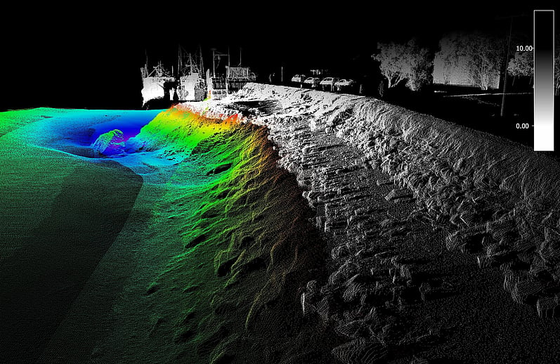
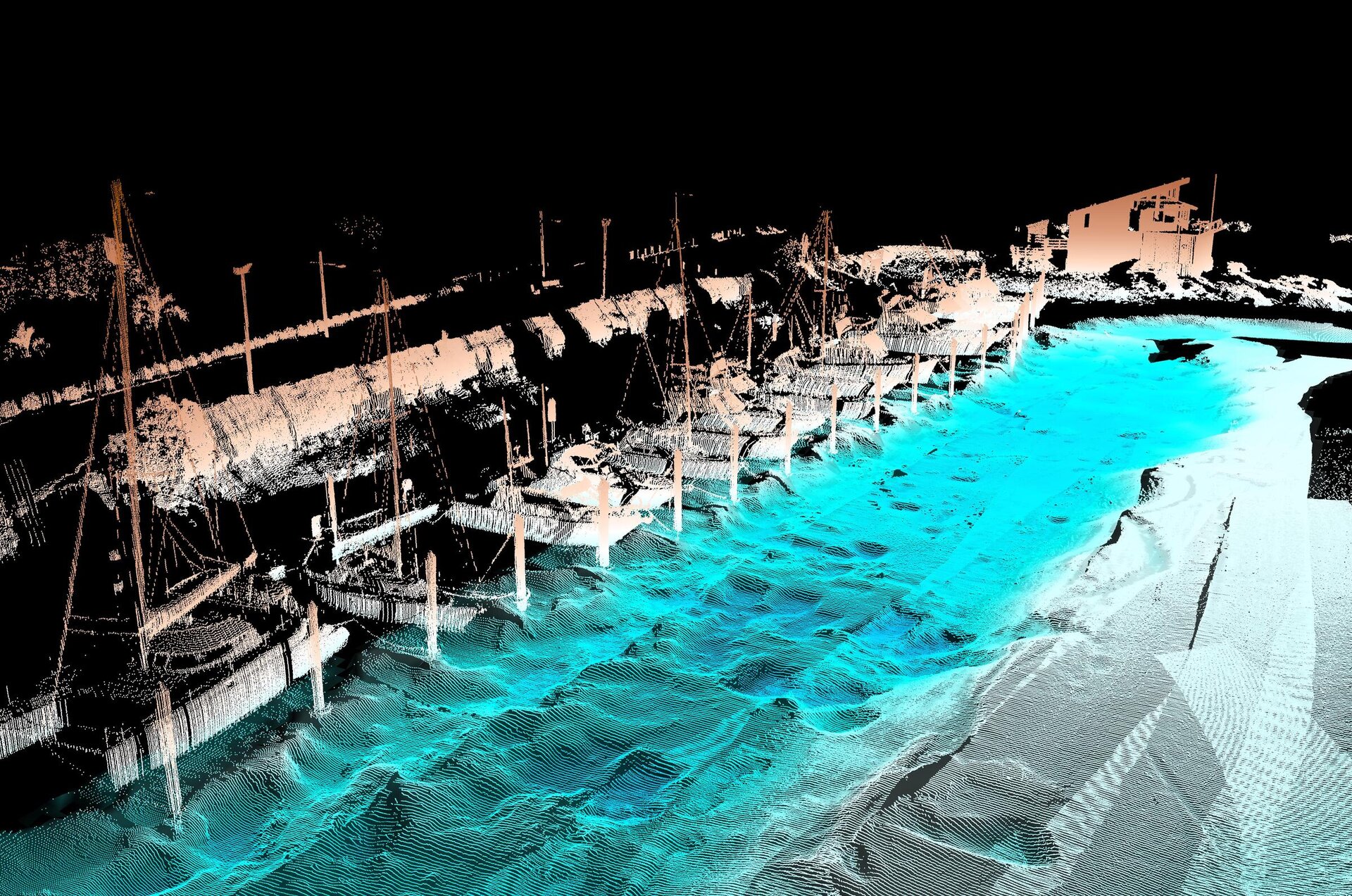
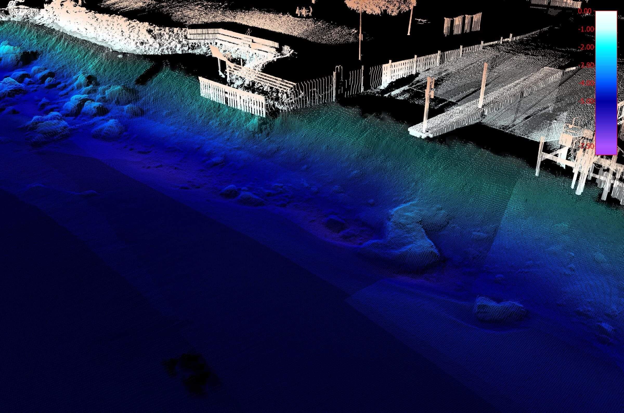
Erosion monitoring of coastlines and lake shorelines is an essential tool for asset protection, flood management and resource consents. The surveys may consist of cross sections, Single Beam Echo Sounder (SBES) surveys, Multibeam Echo Sounder Surveys (MBES), sediment probing, ADCP surveys and Mobile Laser Scanning (MLS) of the adjacent topography.
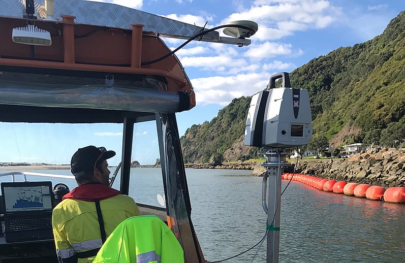
The surveys can be conducted on foot using RTK positioning & photography, aerial photography using a drone, vehicles fitted with MLS and vessels fitted with SBES/MBES/MLS ranging in size from jetski's to purpose built survey vessels 5-7m in length. All vessels and vehicles can be fitted with state of the art positioning, motion sensors and portable survey computers.
Surveying coastlines can be some of the operationally challenging surveys we undertake. New Zealand we encounter shallow rocky outcrops, steep cliffs that prevent easy access, very deep water close to the coast, strong currents, water turbulence, biomass, winds, swell and exposed areas with no place to hide from inclement conditions.
Our steep mountainous terrain can also interfere with achieving good satellite coverage, which is required for accurate positioning and imagery. Coastlines and harbour entrances can encounter high sedimentation rates which can interfere with sensors. However there are solutions to meet most of these challenges. The skill is in selecting the best fit, as one size does not fit all.
DML undertakes many of these surveys for local and regional councils and coastal scientists.
| CASE STUDY
F I E L D W O R K D U R A T I O N :
C L I E N T :